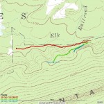
Location: Livonia, Centre county (about 40.9712, -77.2987)
With leaves falling from the trees and snakes and bugs becoming less of a problem, it seemed like a good idea to spend a sunny Sunday afternoon near Livonia. I headed out Rt 192 and stopped at MacNeal Orchards to get some direction on where to find more right of way.
Based on their input, I headed south on Stover Gap Rd a short distance until a shale bank was visible on the west side. Parking there, I headed behind (west of) the shale bank, picking up some logging roads, and angled towards Elk Creek. Before long I was at the base of the hill approaching the stream. It seemed like there was sort of a grade, but it wasn’t very distinct. Continuing west along the base of the hill, I crossed a stream and suddenly I was on pretty distinct grade. I started a GPS track and headed west. Very soon I encountered ledges leading up the hillside to the south, but I decided to continue on the bottom track for a while and explore the ledges on the way back. The grade continued pretty clearly for about 3/4 of mile, then it got a bit vague. I left the GPS and explored ahead, but was a bit concerned I might not find it again. Plus I wanted time to head up those exciting ledges! I halted the track and headed back for my starting point. Based on discussions with the MacNeals, it seems this route continues at least as far west as Wohlford Run and the associated gap, so there is plenty of this level route left to survey on a future visit.
Back at my starting point, I examined my options. A very short stub starts up the hillside and stops after perhaps 150 feet. This appears to be either a false start of a route up the hill, or perhaps a loading ramp location. This is marked on the maps as waypoint “Switchcrap”.
I started climbing the next ledge up the hillside. It rose quickly, making me question how much I’d like to pilot a 20 ton locomotive down this hill after a rainy summer and fall like we’ve had here this year. At the top of the steep climb, it swung to the south with a nice rock fill… no question what this was built for. It then climbed into a bit of a hollow with clear tie depressions in places. Eventually the RoW intersected a dirt road which I am told is gated where it comes off Stover Gap Rd. I poked around a bit and felt the RoW probably continued nearby, but it wasn’t immediately obvious where. I suspended the GPS track and headed back with about 1/4 mile surveyed.
Back at Grand Central Station, I started a new GPS track on the uppermost ledge. This one was disconnected from the others, which seemed odd as it seems the most likely route down from ‘The Haystack’ (see previous post). One possibility is that this was the original route Laurelton Lumber Co. took down to Elk Creek and the Walker Tract, but that it was later abandoned (as work progressed west) in favor of the ledge described above, which might be a bit less steep. Regardless, this ledge also continued up steeply, curved to the south, entered a fair cut through a shale bank, and was rudely interrupted by a sort of road/clearing on the edge of a clear cut area. On the other side of the clearing it appeared the route probably continued, but the thick layer of spice bush made proceeding unattractive. Nevertheless, the direction seemed correct to cross the deer exclusion zone and hook up with previously surveyed grade descending from ‘The Haystack’.
Looking back at the GPS tracks now, I like my theory of the upper ledge being an early route which was replaced by a gentler slope. If you figure both routes climb the same elevation, my proposed later route takes 2-3 times as much length to do it, hence the grade would be substantially less. While the original route might have gotten them started, as they expanded cutting to the west in the Walker Tract it might have been too much of an operational hazard and too difficult to climb with loads.
Note that the areas involved here were part of the ‘Walker Tract’ which Ben Kline’s book describe as “southeast of Livonia”. These were supposedly the last areas cut by Laurelton Lumber and were purchased “in the late 1890s”. The Laurelton sawmill was probably almost 20 miles from here by rail, and crews were probably quite glad when the Walker Tract was exhausted.
Approximate distance added: 1.25 miles
