Category Archives: Centre County railroads

Centre county and Penn State area (non-logging) railroad musings, including the Bellefonte Central, Nittany Valley, Central Railroad of Pennsylvania.

Bellefonte Central: Oreland branch

According to Rails to Penn State, the Oreland branch of the Bellefonte Central RR was built to haul iron ore from Oreland bank on ‘Whipple farm’ to Bellefonte’s iron furnaces. The branch was removed about 1892, when its rails and ties were lifted to build a 1 mile branch into the town of State College. The college was finally growing into something substantial, and the railroad foresaw more potential for traffic in the borough than it did in a modest ore bank.

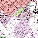
Here is an approximate map I of the branch I created by overlaying Penn Pilot aerial photos from 1938 with modern map data. It’s a pain! But I think I have the route down pretty well. The location of Oreland bank is shown; it’s now Lion’s Gate apartments, more or less. I have also marked the location of a stone quarry mentioned in the book, which was apparently where Hamilton Square shopping center is now. In the image below, it appears as a depression at the top right.

If you know the area, it’s a bit bizarre to visualize an early 4-6-0 steam locomotive moving ore and stone through what’s now shopping centers, apartment complexes, and a high school complex.

If you’d like to experiment with an interactive map of the branch, download this gpx file and upload it to GPSVisualizer.com. You can then view several aerial photo formats, as well as google maps, topos, etc. You can also combine this track with others for the Pine Grove Mills branch, etc.
Bellefonte Central: Pine Grove Mills branch

For some years I have wondered about the short-lived Pine Grove Mills branch of the Bellefonte Central Railroad, mainly because I used to drive across it several times a day. Some parts of its route are evident, some were less clear. Where exactly did it run? And where was the station?

One time I encountered Cecil Irvin (who operates a farm on Nixon Road and has lived his entire life there) and asked if he remembered the route. He pointed out the fence row along his property. And someone (Mike Bezilla?) pointed me to a suspicious foundation adjacent to the PGM school which might have been the station…

I’m currently reading Rails to Penn State by Mike Bezilla and Jack Rudnicki, and I’m back exploring the branch. Unfortunately, recent renovations at PGM school have paved over the site which Bezilla confirms was the station, and I’m fairly certain the foundation was bulldozed out before the paving.

I’ve created a map based on current and historic aerial views…

To play with a “live” map of the branch, download this .gpx file (it is a just a text file, nothing evil) and upload it at GPSVisualizer.com. You will get a live map which you can pan, zoom, switch between various views, e.g. Google hybrid, USGS topo, etc. If you like GPSVisualizer, please send them a couple bucks!

I’ve shown the approximate locations of the related stations and the Struble ore bank. You may also wish to upload .gpx tracks for the Oreland and Gatesburg branches (see other postings), thus creating an interactive map of the whole region.